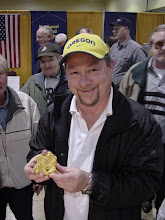
With a last-minute push that took most of the day, I finally finished the manuscript for Gem Trails of Oregon, a guidebook covering rock and gem collecting in the state of Oregon. I thought I'd give you a peek into the frenzy of only missing my deadline by a week.
On December 31, I emailed the publisher with a plea for one more week, and they were fine with that. On January 4, I thought I was done, after putting in a solid weekend that also included taking pictures of various rocks and crystals. But after I made a print, I immediately started making more changes, so it took one more day to really nail it down. Even at that, I imagine I'll keep tweaking until they demand that I stop. Such is the nature of writing docs.
To keep the publisher happy, I created a DVD with the data files for the maps, plus all the pictures, and some Google and Topozone images for the map-maker. (My maps are just a starter; the book publisher's map-maker does an infinitely better job. ) Then I took a look at the Word file and discovered I hadn't run spell-checker in a long time, so I finished that, made some more tweaks even to front and back matter, and then burned a CD with the truly latest and greatest files. I put it all into a UPS envelope and sent it off, then emailed a copy of the PDF file, set at the lowest of the low resolutions.
Actually, I could probably tweak that Acrobat file some more. The Word file is 180 MB in size, which makes me smile, because it used to be that you couldn't trust Word to handle something that large. After all, that's why we have FrameMaker...Anyway, the Acrobat file was about 100 MB after the first time I ran it, so I had to reset the options for "smallest file size." That got it down to 7 MB, but at the risk of no cross-references or links. But I think the pictures are still 300 dots per inch, so there is more room to work. I could probably get my links back and run the pictures down to 72 dpi, but I haven't played with it yet. I'm kind of sick of it right now, actually.
Over the last month, I probably worked on the book every single day or night, and yes, that includes not only Christmas but New Year's Eve. I took my laptop with me to Bend for the family trip, and I used it. Sometimes I'd only get in an hour or two, but I slept better as a result. I think that in total, I probably put in about 200 hours in December to get everything up to where it is. And I can still think of a lot of things I could be doing on it. But now it's time to sit back and wonder what questions I'll get from the publisher, and how fast they can turn it around and get it to the street.
So, I'm pretty happy to be done. I'm ready for another state; we did Washington in 2006, and Oregon is now wrapped up. This summer, the team will be covering Idaho. I expect to use about a dozen helpers, log 15,000 miles, put in about 250 man-days in the field, and take over 100 GPS readings to get to about 75 truly excellent sites. I have a list of about 200 places that serves as a master; we'll see how I do.
Tuesday, January 8, 2008


Wednesday, January 2, 2008
Quest for Closure
By working every day over the break, including the holidays, I managed to get to a reasonable first draft for my upcoming book, Gem Trails of Oregon. The book is a list of 101 top rockhounding spots in Oregon, complete with photographs, maps, and write-ups. Getting to a good place in the end game feels good.
It wasn't pretty -- I was up until four in the morning some nights, and the pressure I put on my family was a bit extreme. But I managed to do it without causing my wife to file for divorce, so I can nearly claim "Mission Accomplished." If this was my full-time job, I wouldn't have to worry so much about squeezing in time for writing alongside walking the dogs, attending family functions, and keeping a household going.
On the other hand, it helped that my day job went on winter break at just the right time. Plus teaching is on holiday, so there weren't any distractions there, either.
Now that I have a printed copy of the entire book, I see a lot of things to fix. Several maps need more work, the print quality is low, and some of the headings are off. But the text is in good shape, and there is a lot of research material for each locale to assist the corporate map-maker. He was slowed down a lot on the Washington book just trying to make sense of everything. I created subdirectories this time with Google maps, topographic maps, and any brochures I could find.
The last days were pretty fun, actually. I had a photographic "studio" set up to take detailed pictures of some of the crystals I found over the summer. Plus I had all my samples out, to make sure the write-ups were accurate. I had maps all over my home office, and piles of books. The whole thing seemed to reach a crescendo right as the University of Oregon was creaming Southern Florida in the Sun Bowl. As the score mounted, I started cleaning up, putting samples away, and taking down the lights for the studio. I folded up a few maps, archived everything off onto a trusty USB drive, and went out for a New Year's Eve party. The next day, I went in to work and used the powerful two-monitor system there to finish off the last map and make a print.
Over the last 24 hours, I've amassed an entire page of corrections to make, but I already begged for forgiveness from the publisher and got an extension to hand everything in over the weekend. So...one more final push and I should be able to relax. A little.
It wasn't pretty -- I was up until four in the morning some nights, and the pressure I put on my family was a bit extreme. But I managed to do it without causing my wife to file for divorce, so I can nearly claim "Mission Accomplished." If this was my full-time job, I wouldn't have to worry so much about squeezing in time for writing alongside walking the dogs, attending family functions, and keeping a household going.
On the other hand, it helped that my day job went on winter break at just the right time. Plus teaching is on holiday, so there weren't any distractions there, either.
Now that I have a printed copy of the entire book, I see a lot of things to fix. Several maps need more work, the print quality is low, and some of the headings are off. But the text is in good shape, and there is a lot of research material for each locale to assist the corporate map-maker. He was slowed down a lot on the Washington book just trying to make sense of everything. I created subdirectories this time with Google maps, topographic maps, and any brochures I could find.
The last days were pretty fun, actually. I had a photographic "studio" set up to take detailed pictures of some of the crystals I found over the summer. Plus I had all my samples out, to make sure the write-ups were accurate. I had maps all over my home office, and piles of books. The whole thing seemed to reach a crescendo right as the University of Oregon was creaming Southern Florida in the Sun Bowl. As the score mounted, I started cleaning up, putting samples away, and taking down the lights for the studio. I folded up a few maps, archived everything off onto a trusty USB drive, and went out for a New Year's Eve party. The next day, I went in to work and used the powerful two-monitor system there to finish off the last map and make a print.
Over the last 24 hours, I've amassed an entire page of corrections to make, but I already begged for forgiveness from the publisher and got an extension to hand everything in over the weekend. So...one more final push and I should be able to relax. A little.
Tuesday, December 18, 2007
Chicken, Alaska
In between many other writing assignments, I write a short column about gold prospecting for Gold Prospectors magazine. Here's the next column:
***
***
Mining the Internet – Chicken,
By Garret Romaine
Two years ago I contacted Mike Busby about his website, http://www.chickengold.com and wrote up a few details about the new site, which describe his fee-dig operation up there. I’m happy to report that in the months since then, Mike has put a lot of work into his website (and his mining operation). If you have a vacation planned for the
Chicken,
Gold Discovery
Myer’s Fork flows into Chicken Creek just north of Chicken, and Chicken Creek reaches the Mosquito Fork of the
The Chicken Creek drainage has been mined continuously since 1896, yielding about 100,000 ounces. The F.E. Company, a subsidiary of the U.S. Smelting Refining & Mining Co., acquired most of the claims during the 1940’s and dredged 2 miles of Chicken Creek from 1959 to 1967. Since then, several family operations have mined on the creek.
Mike continues: “We began operating the Chicken Creek Mine in 1990 as lessees and purchased ground in 1998. In 2000, we began to implement a sustainable development plan incorporating mining, reclamation, tourism and local history. In 2001, our efforts were recognized by the State of
Lately, our mining operation has taken a back seat to the rest of the business, but we continue to operate the Chicken Creek Mine as time permits. When we are operating, you are welcome to view the operation. And when we are not, there is plenty of gold for you to find, since most of the remaining ground is available for panning and recreational mining opportunities.”
Gold nuggets to three ounces are reported from this area. Guests at the claims can work the creek for a daily fee. You can pan, sluice, run a metal detector, or operate a high-banker or sluice. Sluice intakes are limited to two inches in diameter. Rates are subject to change, but run as follows:
$15 per day for panning and metal detecting
$25 per day for hand sluices
$30 per day for high bankers
$40 per day for sluices
Rates are slightly higher for non-camping guests. There are also weekly discounts. The camp offers equipment rentals, concentrate clean-up, and demonstrations.
Pedro Dredge
http://www.explorenorth.com/library/mining/pedro_dredge.html
The Pedro Dredge is open for daily tours and is definitely worth a stop. Mike Busby wrote this article for ExploreNorth.com. The dredge was smaller than most
Here are a few excerpts:
“The Pedro dredge, originally driven by steam, was built by the Yuba Manufacturing Company in
“During its production years on Chicken Creek, the dredge washed about 2,500 cubic yards of gravel each day (29 buckets per minute) at a cost of around 30 cents per cubic yard. Between 0.30 and 0.80 ounces of gold were recovered from each cubic yard of gravel. There were normally 16-20 men employed in the operation, with 10-12 involved directly with the dredging and the remainder mostly associated with thawing ground ahead of the dredge. The dredge mined over 55,000 ounces of gold in the eight years on Chicken Creek.”
“Until 1998, the Pedro Dredge was hardly visible, resting on upper Chicken Creek where it had been parked in 1967. In the fall of 1998, the dredge was moved a mile to it's present location in the center of Chicken by it's new owner, Bernie Karl, and the owner of the mining claims, Mike Busby. The million-pound artifact was moved in one piece, and took less than two weeks of preparation and two weeks of actual moving, during which 120 tires were used to support it.”
Tisha’s Grave
At the north end of Chicken is a small grave marker with the following history behind it:
From http://www.explorenorth.com/library/bios/purdy-ann_hobbs.html: “Anne Hobbs Purdy was born on November 10, 1901 in
I haven’t read the book, but Maudeen Wachsmith provided a short review at Amazon.com:
“Anne Hobbs is a prim and proper 19-year-old schoolteacher who yearns for adventure. She finds this and much more in a town with the unlikely name of Chicken, located deep in the Alaskan interior. It is 1927 and Chicken is a wild mining community flaming with gold fever. Anne quickly makes friends with many of the townspeople, but is soon ostracized when she not only befriends the local Indians but also falls in love with one.”
More info
http://www.explorenorth.com/library/communities/alaska/chicken.html
There are additional reference links form this page, taking you to information about the Chicken Hotel, downtown Chicken, several other large-scale dredges that offer tours, and a geologic map of the Chicken,
Additional References
Myers Fork is cited in the following literature:
Cobb, E.H., 1977, Summary of references to mineral occurrences in the Eagle quadrangle,
Foster, H.L., 1969, Reconnaissance geology of the Eagle A-1 and A-2 quadrangles,
Mertie, J.B., Jr., 1938, Gold placers of the Fortymile, Eagle, and Circle districts,
Prindle, L.M., 1909, The Fortymile quadrangle, Yukon-Tanana region,
Prindle, L.M., 1905, The gold placers of the Fortymile, Birch Creek, and
Yeend, W., 1996, Gold placers of the historical
Down to the wire
My manuscript for the revision to "Gem Trails of Oregon" is in pretty good shape, but there is still a lot to do. I thought I'd offer up a little commentary on the frantic rush to hit a deadline.
First, I still need to comb through each of the 101 entries for each general locale and make sure I have the sites thoroughly documented. I found two last night that aren't ready, and by far, the Glass Buttes obsidian deposit is the most difficult. Tim Fisher's OreRockOn DVD lists about 15 different GPS coordinates around Glass Buttes, and I don't want to include any more than 5. So I need to whittle what I have down to a manageable number. I have a similar problem with another deposit in SE Oregon, where there are several sites listed in the literature that I need to sort out.
Then there are the fossil locales. Because I am burdened with a geology degree, I feel this insane need to publish formal formation names for various locales. This is especially important with regards to fossil locales, as you like to know the age of the material you are digging up. Late last night I went through several of the limestone locales and ascribed to them the correct geologic information. But a few remain, and there are others that are incidental to the main material collected at a locale. So I have some research to do there, but fortunately the book "Fossils of Oregon" is a great guide.
I have completely worked through each site and verified the GPS coordinates, and in an improvement over my original data, I converted each reading to something simple for Google Earth. In the old days, GPS coordinates would read something like 45 degrees, 25 minutes, 11.5 seconds for the latitude, and 117 degrees, 24 minutes, 54.4 seconds for the longitude. Obviously, using the degrees, minutes, and seconds notation shortens those readings, but not enough. I converted everything to decimals: 45.4354, -117.3895 would be a close approximation for that reading above. There is much less typing involved, and the readings are useful for Google Earth, the most popular (and free) global mapping program. It was a lot of work, but I feel better about the conversion. I also verified the elevation readings, which my GPS unit sometimes messes up.
Lately I also worked on naming for the sites, since I had used some obscure geographical references for a couple sites that nagged at me. I made those changes this week as well. It amazes me how the smallest details grind on me as I try to get this project finished.
I also overhauled a small, eight-cell table I put under each map with information such as road conditions, seasonal availability, relevant maps, nearby attractions, etc. A font glitch required me to go through each table and reformat the text, which was time-consuming.
One final project has been to give better, specific driving instructions for each location. Even though some readers have good GPS units and mapping software, not everyone does. So I spend a lot of space describing how to get somewhere. I try to tie everything to an interstate freeway, as though the reader were driving straight to this location. The truth is, many readers will be coming from a nearby locale, so I have to cover that information as well. There is still some work to do there. Being a big user of guidebooks myself, I feel strongly about getting the mileages correct. But it often requires a lot of tedious work, pasting in the GPS coordinates into Google Earth and working with the ruler to measure road lengths.
The biggest challenge left is drawing site maps for each locale, using Adobe Illustrator. I worked out a template for each map, with a small gray outline of the state marked with faint county lines. I need to put a relative dot on that state icon for each locale, and then draw in lines for roads, rivers, streams, etc. Then I need to place an "X" marks the spot for the specific spot. Each map can take an hour, and I have a hundred to complete before the end of December.
The good news is two-fold; first, I have a new, fast computer at work, with dual flat-screen monitors so I can really stretch out my desktop real estate. Second, my day job goes on hiatus after Christmas. I may come into the office a few times just to work on maps.
Needless to say, I am not getting much sleep. I keep running spell-checker, rooting out passive voice, fixing punctuation, and combing through the text. I have a running debate with myself about how much first-person voice to use. It requires some linguistic gymnastics to write some of the descriptions in a flat, second-person imperative. I want the text to sound personable, and I think it makes the entire book more believable. But sometimes I feel too much of myself creeping in, as though I am writing just for my rockhound uncle. He helped out a lot on the field research this summer, so he shows up on several pages. I wrestle with how much personal information to include.
By New Year's Day, I should be finished. But it looks pretty scary at this point. There is so much to do, and I feel like I am procrastinating on the hardest parts. Plus, I still have to be a father, husband, son, friend, associate...I can't just hunker down and work non-stop. But I like the writing, so I pour a lot of myself into it.
OK, gotta go...
First, I still need to comb through each of the 101 entries for each general locale and make sure I have the sites thoroughly documented. I found two last night that aren't ready, and by far, the Glass Buttes obsidian deposit is the most difficult. Tim Fisher's OreRockOn DVD lists about 15 different GPS coordinates around Glass Buttes, and I don't want to include any more than 5. So I need to whittle what I have down to a manageable number. I have a similar problem with another deposit in SE Oregon, where there are several sites listed in the literature that I need to sort out.
Then there are the fossil locales. Because I am burdened with a geology degree, I feel this insane need to publish formal formation names for various locales. This is especially important with regards to fossil locales, as you like to know the age of the material you are digging up. Late last night I went through several of the limestone locales and ascribed to them the correct geologic information. But a few remain, and there are others that are incidental to the main material collected at a locale. So I have some research to do there, but fortunately the book "Fossils of Oregon" is a great guide.
I have completely worked through each site and verified the GPS coordinates, and in an improvement over my original data, I converted each reading to something simple for Google Earth. In the old days, GPS coordinates would read something like 45 degrees, 25 minutes, 11.5 seconds for the latitude, and 117 degrees, 24 minutes, 54.4 seconds for the longitude. Obviously, using the degrees, minutes, and seconds notation shortens those readings, but not enough. I converted everything to decimals: 45.4354, -117.3895 would be a close approximation for that reading above. There is much less typing involved, and the readings are useful for Google Earth, the most popular (and free) global mapping program. It was a lot of work, but I feel better about the conversion. I also verified the elevation readings, which my GPS unit sometimes messes up.
Lately I also worked on naming for the sites, since I had used some obscure geographical references for a couple sites that nagged at me. I made those changes this week as well. It amazes me how the smallest details grind on me as I try to get this project finished.
I also overhauled a small, eight-cell table I put under each map with information such as road conditions, seasonal availability, relevant maps, nearby attractions, etc. A font glitch required me to go through each table and reformat the text, which was time-consuming.
One final project has been to give better, specific driving instructions for each location. Even though some readers have good GPS units and mapping software, not everyone does. So I spend a lot of space describing how to get somewhere. I try to tie everything to an interstate freeway, as though the reader were driving straight to this location. The truth is, many readers will be coming from a nearby locale, so I have to cover that information as well. There is still some work to do there. Being a big user of guidebooks myself, I feel strongly about getting the mileages correct. But it often requires a lot of tedious work, pasting in the GPS coordinates into Google Earth and working with the ruler to measure road lengths.
The biggest challenge left is drawing site maps for each locale, using Adobe Illustrator. I worked out a template for each map, with a small gray outline of the state marked with faint county lines. I need to put a relative dot on that state icon for each locale, and then draw in lines for roads, rivers, streams, etc. Then I need to place an "X" marks the spot for the specific spot. Each map can take an hour, and I have a hundred to complete before the end of December.
The good news is two-fold; first, I have a new, fast computer at work, with dual flat-screen monitors so I can really stretch out my desktop real estate. Second, my day job goes on hiatus after Christmas. I may come into the office a few times just to work on maps.
Needless to say, I am not getting much sleep. I keep running spell-checker, rooting out passive voice, fixing punctuation, and combing through the text. I have a running debate with myself about how much first-person voice to use. It requires some linguistic gymnastics to write some of the descriptions in a flat, second-person imperative. I want the text to sound personable, and I think it makes the entire book more believable. But sometimes I feel too much of myself creeping in, as though I am writing just for my rockhound uncle. He helped out a lot on the field research this summer, so he shows up on several pages. I wrestle with how much personal information to include.
By New Year's Day, I should be finished. But it looks pretty scary at this point. There is so much to do, and I feel like I am procrastinating on the hardest parts. Plus, I still have to be a father, husband, son, friend, associate...I can't just hunker down and work non-stop. But I like the writing, so I pour a lot of myself into it.
OK, gotta go...
Monday, December 10, 2007
Why try?
One of my friends asked me recently why I am standing for election to the Society for Technical Communication Board of Directors. After all, I ran several years ago and lost by 21 votes, so why risk public humiliation one more time?
I guess the short answer is because I think I can be of service. Technical communication has been good for me over the years; it has put a roof over my head and put food on the table. I've met interesting people, worked at energetic companies, and been part of inspirational teams. Plus, the constant vocabulary lessons have been good for my Scrabble game. So on many levels, I feel the need to give back.
I believe in the old electoral adage, "If you don't vote, you can't complain." Stated another way, if you don't participate in elections with your vote, you shouldn't really vocalize your displeasure with how things are run. STC members are like any other members of professional organizations -- voting participation is anemic. But taken to the next level, is just voting enough? Shouldn't members work hard as volunteers, finding ways to plug into the organization and work to make it better?
I think they should. Over the years, I have served the Society in many, many roles. In each case, I like to thing I got something back in return. When I ran the Employment committee, I learned a lot about sending out email blasts, including the last-minute triple-check that saves so much public embarassment. I also made a lot of contacts with local employers, and got first-hand glimpses about many of the managers in the local area. When I served as a competition volunteer, I started really inspecting my own documentation as a judge would see it, and I like to think that made me a better writer.
So now comes the chance to work for change at a national level. I know that a lot of members are disappointed that dues rose significantly, and I hear complaints about the Transformation that I admit I am sympathetic to. At the same time, I have met (and worked with) some of the Board members, and I believe they voted in some of the more controversial measures based on the best information they had at the time. Change is always painful if it is significant. Yet people adapt and move on. We are resilient.
Plus, many of the age-old complaints are still out there. Organizations sometimes discount our value. Engineers sit on reviews and complain about deadlines. Our managers seem to face continually dwindling budgets. Outsourcing is a real threat. Still, tools continue to evolve and schools continue to churn out graduates. Life goes on.
If elected, I plan to bring a lot of energy to this new task. I plan to do my homework, come prepared to meetings, and communicate back to members as best I can. I know that I'm a longshot to win -- being based in the Pacific Northwest, I don't have what you would call a big constituency backing me. So I'm realistic, if not fatalistic. There are eight great candidates for only four openings, and it is an honor just to be included in the group, come what may.
I guess the short answer is because I think I can be of service. Technical communication has been good for me over the years; it has put a roof over my head and put food on the table. I've met interesting people, worked at energetic companies, and been part of inspirational teams. Plus, the constant vocabulary lessons have been good for my Scrabble game. So on many levels, I feel the need to give back.
I believe in the old electoral adage, "If you don't vote, you can't complain." Stated another way, if you don't participate in elections with your vote, you shouldn't really vocalize your displeasure with how things are run. STC members are like any other members of professional organizations -- voting participation is anemic. But taken to the next level, is just voting enough? Shouldn't members work hard as volunteers, finding ways to plug into the organization and work to make it better?
I think they should. Over the years, I have served the Society in many, many roles. In each case, I like to thing I got something back in return. When I ran the Employment committee, I learned a lot about sending out email blasts, including the last-minute triple-check that saves so much public embarassment. I also made a lot of contacts with local employers, and got first-hand glimpses about many of the managers in the local area. When I served as a competition volunteer, I started really inspecting my own documentation as a judge would see it, and I like to think that made me a better writer.
So now comes the chance to work for change at a national level. I know that a lot of members are disappointed that dues rose significantly, and I hear complaints about the Transformation that I admit I am sympathetic to. At the same time, I have met (and worked with) some of the Board members, and I believe they voted in some of the more controversial measures based on the best information they had at the time. Change is always painful if it is significant. Yet people adapt and move on. We are resilient.
Plus, many of the age-old complaints are still out there. Organizations sometimes discount our value. Engineers sit on reviews and complain about deadlines. Our managers seem to face continually dwindling budgets. Outsourcing is a real threat. Still, tools continue to evolve and schools continue to churn out graduates. Life goes on.
If elected, I plan to bring a lot of energy to this new task. I plan to do my homework, come prepared to meetings, and communicate back to members as best I can. I know that I'm a longshot to win -- being based in the Pacific Northwest, I don't have what you would call a big constituency backing me. So I'm realistic, if not fatalistic. There are eight great candidates for only four openings, and it is an honor just to be included in the group, come what may.
Tuesday, November 13, 2007
We got skills

On Saturday, November 10, I hosted a book-signing party at my house to celebrate the publication of my first book, Gem Trails of Washington. It was the most fun I've had in a long time, what with a bevy of life-long friends and close relatives streaming in and out, picking up a heavily-discounted copy of the book and asking for a few hand-written words up front. I even got interviewed by the media -- although, in fairness, "the media" was a ten-year old girl working on a school project.
I'm hoping to put together a formal article or presentation on the whole project, to give technical communicators some ideas for their own publication. In fairness, it wasn't that hard, and I had a great time. Sure, my wife was missing me on the many weekends I was out collecting without her, but it didn't seem like that much work to mount continued road trips into the hinterlands. My belief is that we technical writers have the skills and abilities to branch out from writing online help and technical manuals. As a group, we are familiar with every facet of the writing process, skilled in research and data-gathering, able to meet deadlines, and our skin is thick enough to withstand the editing process without too much angst. When we become our own Subject Matter Expert, what's not to like?
The book, now available at Amazon.com, is a list of 78 different locales in Washington state of interest to anyone who likes to collect rocks, gems, and fossils. I personally visited each site, used my digital camera to collect over 600 images, used a GPS device to record detailed latitude and longitude coordinates, and organized a collection of samples that I could come back to when writing up each spot. I used a laptop with an AC/DC converter in the field to write down first impressions and later went into more detail. I used Adobe PhotoShop to clean up the pictures, used Adobe Illustrator to create the maps, and used Adobe Acrobat to create drafts for the publisher to gauge my progress.
In addition, I used the following online tools:
1. TopoZone.com for digital topographic maps. I used my field record of the GPS coordinates and verified that I was, in fact, where I thought I was, and in more than one case corrected transposed entries that would have placed the reader in the middle of a lake or river.
2. GoogleEarth for aerial photographs of the places I was either researching or confirming. This program was especially helpful in planning trips, as I could tell whether camping would be an option or if I was likely to be in the middle of a rancher's field. I also used the measuring tool to refine mileage estimates and record road information.
3. Mapquest.com for road maps to and from locales. In some cases, Mapquest showed roads that did not exist, but in other cases, I found short-cuts and easier routes.
4. Google Maps was another good road mapping program. In order to get readers to a certain spot, I had to know the roads and provide mileages. Many times the roads are not marked in the field, so my notes had to be accurate. Google Maps has a toggle between photos and maps that was very helpful.
5. BLM LR2000 is an online claims record that shows land ownership patterns. I can't send readers to a site that is actually someone else's mining claim, so this tool was helpful in avoiding mistakes.
6. Rocks and Minerals Mailing List was a good online discussion board for asking specific questions to other rockhounds who knew as much, or more, than I did about collecting in Washington.
7. Weather.com helped in planning trips both long-term and short-term. Knowing precipitation patterns, I developed a plan that allowed for knocking out all the high-elevation sites first, then picking off the western areas of the state that see the most rain, and finishing in lower elevations in eastern Washington as the weather turned cold.
8. State of Washington WebCams helped me understand traffic bottlenecks, pass conditions, and road construction projects to avoid.
9. JBO-Night Sky helped me keep on the lookout for stars, planets, comets, meteor showers, satellites, and other interesting celestial objects that wandered across the starry nights. Heck, once you're out camping, you might as well enjoy the whole experience.
On top of those tools, I used email to keep in touch with other rockhounds, and I frequented the websites for U.S. Forest Service regional offices, where fire conditions were posted as well as road construction projects. I used an Excel spreadsheet to keep track of mileage and expenses, which kept the accountants happy. I used FullShot to take screen captures of images and maps, and then pasted them into PowerPoint because the landscape orientation made it easier to view the information.
Finally, my PC skills were put to the test. I updated my PC to Windows Vista, beefed up the memory, and installed a new hard drive to handle the expected surge in data. I managed my file backups, created directories for each locale to store digital pictures, burned data DVDs to ensure the project files were safe, and carried a USB drive around in my pocket as another backup device.
The payoff was last week's party. The book won't be on any best-seller lists, as it is a small niche market. When my grandparents were taking us kids out into the woods in the 1960s, it seemed like a lot more families were involved in camping, hiking, and picking up rocks, but the hobby is not as popular today. No worries; I'm not in it for the money. I am hard at work on a companion guide covering the state of Oregon, and next year I will complete a contract for the state of Idaho. After that...who knows? It's a big world out there. "Gem Trails of Antarctica" has a nice ring to it.
Friday, November 9, 2007
The Next Crop
I submitted a proposal to take part in a progression at the Society for Technical Communication conference in Philadelphia next summer. The topic concerns reaching out to the high school level to describe technical writing as a career option. Earlier this year I spoke to a group of high school science teachers about getting better writing from their students. The topic continues to intrigue me, and I have started to contact local schools to get more opportunities around Career Days.
In the dark, dim past it seemed like there was a very low barrier to entry for aspiring technical writers. Basically, anyone caught conjugating a verb properly was a likely candidate. The writing staff at some companies was comprised of technicians, secretaries, journalists, frustrated novelists, and the like. It seemed like half the staff was there by accident.
Fast-forward to 2007 and the writing staff is far different. Most technical communicators have degrees in their chosen field, or degrees in English, Journalism, etc. In other words, the writers are here by choice.
My hope is to get more representation at the high school level and help students identify the technical communication career as a viable path. As I find out more, I'll keep blogging about it.
In the dark, dim past it seemed like there was a very low barrier to entry for aspiring technical writers. Basically, anyone caught conjugating a verb properly was a likely candidate. The writing staff at some companies was comprised of technicians, secretaries, journalists, frustrated novelists, and the like. It seemed like half the staff was there by accident.
Fast-forward to 2007 and the writing staff is far different. Most technical communicators have degrees in their chosen field, or degrees in English, Journalism, etc. In other words, the writers are here by choice.
My hope is to get more representation at the high school level and help students identify the technical communication career as a viable path. As I find out more, I'll keep blogging about it.
Subscribe to:
Posts (Atom)