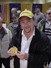
I was recently asked to "capsulize" some of the rockhounding locales around the Portland area for an article in "Metroscape," published at Portland State University. It was a fun task, as it basically meant taking my book text and cleaning it up a little. It was also a nice little nostalgia tour to think about some of those areas that I haven't been to in a year or so.
In all, I wrote up six sites:
1. Clackamette Park, where the Clackamas river joins the Willamette. Good supply of rounded river rock with agates and jaspers throughout.
2. Memaloose Bridge, far up the Clackamas almost to Ripplebrook Ranger Station, with mostly agate and jasper but also some zeolites and other oddities.
3. Independence Island, my favorite canoe trip from last summer when the water was low. More agate and jasper, plus excellent petrified wood.
4. Cedar Butte, a noted locale for black crystals of augite. The material is lying in the dirt and in the cliffs, and kids love it.
5. Nehalem River, another river walk that has the usual suspects plus fossil concretions and Indian artifacts.
6. Washougal River in Washington, with good agate and jasper from the Columbia River.
I'm anxious to see what the editor does with all my hand-drawn maps. I'll let you know.
Thursday, May 8, 2008


Wednesday, May 7, 2008
Electoral Curse
Well, I lost my election. I didn't just lose - I was obliterated, finishing in last place by a handful of votes. All in all, I would have needed about 150 more votes to win a position on the board, but it was not to be.
I'm not all that broken up. Sure, the public humiliation hurts, and it's tough to be rejected by your peers. But so few members vote -- about 1100 out of 14,000 members -- that I don't have to accept that it was an outright repudiation.
Anyway, I wasn't really sure where the time was going to come from anyway. I still have the field research for Idaho to complete, and then I have to write the locales up and finish that manuscript. There is going to be an editing phase on the Oregon book, as well. Plus I have a lot of magazine articles to write over the next year. So...it could be a blessing to lose the election.
Meanwhile, I have to finish my presentation for the Philadelphia conference in June. It isn't like some of my STC duties will go away. But at least they won't be increasing exponentially.
I'm not all that broken up. Sure, the public humiliation hurts, and it's tough to be rejected by your peers. But so few members vote -- about 1100 out of 14,000 members -- that I don't have to accept that it was an outright repudiation.
Anyway, I wasn't really sure where the time was going to come from anyway. I still have the field research for Idaho to complete, and then I have to write the locales up and finish that manuscript. There is going to be an editing phase on the Oregon book, as well. Plus I have a lot of magazine articles to write over the next year. So...it could be a blessing to lose the election.
Meanwhile, I have to finish my presentation for the Philadelphia conference in June. It isn't like some of my STC duties will go away. But at least they won't be increasing exponentially.
Friday, May 2, 2008
Turkey trouble

I've made five trips so far to Idaho, and so far I've had to stick mainly to low-altitude areas. The snowpack is at least 150% of normal this year, ending a long drought. The farmers and ranchers are thrilled, but I'm caught in a bind. Most old ghost towns and mining camps are way up in the hills, and snow blocks most of those old roads. Plus the waters are roaring off the hills and it isn't as easy to find material in the limited gravel bars exposed so far.
The final challenge has been wildlife. Three weeks ago we saw a herd of elk, a herd of deer, and a herd of antelope within six hours of each other. There have been birds swerving in front of the car, rabbits dashing across the bumper, and eagles soaring through the skies. But the worst has been a crotchety old gobbler at Mineral, Idaho.
To reach Mineral, drive west from Weiser about six miles and head north on Rock Creek Road. Eventually you cross through a pass at about 4200 feet and wind back down into the Snake River canyon, sort of the southern end of Hells Canyon. The road dumps out on a small windy track that parallels the river, and just before a private lodge, a set of tracks comes in from the east along Dennett Creek. This leads to the old mining camp at Mineral. There are three buildings still standing, plus lots of tailings piles and mining artifacts. Best are the adits driven into solid rock, which are much safer to climb into than anything shored up with rotting timber.
My Dad and I drove hard all day, hitting several new sites, and arrived at Mineral fairly tired. There was a lot of firewood on the ground, and nobody around, so we camped at a very prominent point along the road and got a roaring blaze going. But I heard rocks crashing down on the slope across from us, and my flashlight didn't really reveal anything. We started swapping old stories and laughing and releasing a little stress.
Dad started in on some improbable tale that made him laugh so much he forgot the punchline, and he finished with cackle that echoed across the old camp. Suddenly, from about 300 yards away, we heard a turkey gobble that was decidedly unfriendly. "Gobble-gobble-gobble-gobble" in no uncertain terms.
It's funny how you know immediately what made that noise. We laughed, quietly, and decided to toss on another log, open another beer, and ignore him. I heard more rock moving on the hillside, but it wasn't any mystery so no worries there. Then Dad laughed way too loud again, and there came that admonition: "Gobble-gobble-gobble-gobble." And he was even madder this time, as if to say, "Now listen. This was a nice quiet town before you hooligans showed up. Let's keep it down over there."
And this time the turkey was a lot closer - maybe 75 yards. My idea was to toss a rock at him, or maybe chase him with a stick for a turkey dinner. But there was downed barbed wire all over out there, and it would have been dangerous to go rampaging after him that late at night. So we quieted down a little, and soon, Dad went to bed. Then so did I. Under the watchful eye of a wild turkey posing as a small-town sheriff.
Thursday, March 20, 2008
First trip of the season
Here we go! In about 24 hours I'm off to Marsing, Idaho, on my first collecting trip of the season. It's an absolutely crazy thing to be contemplating -- the snow is still falling at the higher elevations, the snowpack is thicker than its been in a generation, and by all forecasts the weather will be freezing on Friday and Saturday nights. But it's time.
I haven't been on an overnighter since November, 2007, and I've got a serious case of cabin fever. All through the winter I've been trying to plot out a regimen of seven-day, three-day, and two-day trips that will cover Idaho. My contract with Falcon Guides requires a manuscript by December 31, 2008. While I have extensive experience up and down the state of Idaho, I have a lot of work to do. I need to visit at least 200 spots and collect photographs, samples, and GPS readings. From that superset of readings, I'll whittle down the grand total to 100 sites. But I may be able to collect geographically proximate locales and really pack them in.
Tomorrow I'm headed for southwest Idaho. From Portland I'll head out I-84 to Ontario, then take Exit 3 south on US 95 to Homedale, then Marsing. US 95 curls back into Oregon, and I'll probably drive all the way down, then double back. I have about 17 places plotted out, in conjunction with a field trip sponsored by the Idaho Gem Club, which I just joined last month.
If you know a little about Idaho, there are some amazing locales out along the Oregon border. Graveyard Point Road actually starts from US 95 and ends up in Oregon, so I won't have to go all the way out to those spots along the rim -- wrong state! There is an old mercury mine out along Poison Creek Road, and an agate locale as well, but those aren't my main targets. I will be collecting petrified wood at Coal Mine Basin (if not covered in snow) and opal and agate along McBride Creek. The last spot I visited last year was on the Idaho side of the road along McBride Creek, so there is a nice symmetry there. Then I'll head out Sommer Camp Road for a jaunt to Opalene Gulch and connect up a couple spots documented by the Great Lanny Ream in his 2004 guide.
I was hoping to camp at Jump Creek Falls trailhead, but it turns out that is a "day use only" spot. Too bad - there is an outhouse, some picnic tables, and a fire pit there. We'll be roughing it out along Sommer Camp Road, I expect. At least we don't have to worry about fire season restrictions in March. If I have room in the car, I'll bring a little wood.
My son Nelson, his friend Jake, and my uncle Doug will be in my car, while my friend Marty "Dusty Fingers" Schippers, a noted soapstone carver, will come down from Seattle. Marty and I have hooked up so many times in the dead of night that we're not too worried. Usually one of us gets to a pre-organized spot early, and when they spy a set of headlights bumping up the road, the connection is made.
Over-packing is a big concern. I try to keep it down, and there is not going to be any lashing of gear to the top of the rig, as it will probably rain. But tent camping out of a car isn't too demanding; as long as you have room for a couple coolers, you're fine.
Anyway, it's good to be headed out.
I haven't been on an overnighter since November, 2007, and I've got a serious case of cabin fever. All through the winter I've been trying to plot out a regimen of seven-day, three-day, and two-day trips that will cover Idaho. My contract with Falcon Guides requires a manuscript by December 31, 2008. While I have extensive experience up and down the state of Idaho, I have a lot of work to do. I need to visit at least 200 spots and collect photographs, samples, and GPS readings. From that superset of readings, I'll whittle down the grand total to 100 sites. But I may be able to collect geographically proximate locales and really pack them in.
Tomorrow I'm headed for southwest Idaho. From Portland I'll head out I-84 to Ontario, then take Exit 3 south on US 95 to Homedale, then Marsing. US 95 curls back into Oregon, and I'll probably drive all the way down, then double back. I have about 17 places plotted out, in conjunction with a field trip sponsored by the Idaho Gem Club, which I just joined last month.
If you know a little about Idaho, there are some amazing locales out along the Oregon border. Graveyard Point Road actually starts from US 95 and ends up in Oregon, so I won't have to go all the way out to those spots along the rim -- wrong state! There is an old mercury mine out along Poison Creek Road, and an agate locale as well, but those aren't my main targets. I will be collecting petrified wood at Coal Mine Basin (if not covered in snow) and opal and agate along McBride Creek. The last spot I visited last year was on the Idaho side of the road along McBride Creek, so there is a nice symmetry there. Then I'll head out Sommer Camp Road for a jaunt to Opalene Gulch and connect up a couple spots documented by the Great Lanny Ream in his 2004 guide.
I was hoping to camp at Jump Creek Falls trailhead, but it turns out that is a "day use only" spot. Too bad - there is an outhouse, some picnic tables, and a fire pit there. We'll be roughing it out along Sommer Camp Road, I expect. At least we don't have to worry about fire season restrictions in March. If I have room in the car, I'll bring a little wood.
My son Nelson, his friend Jake, and my uncle Doug will be in my car, while my friend Marty "Dusty Fingers" Schippers, a noted soapstone carver, will come down from Seattle. Marty and I have hooked up so many times in the dead of night that we're not too worried. Usually one of us gets to a pre-organized spot early, and when they spy a set of headlights bumping up the road, the connection is made.
Over-packing is a big concern. I try to keep it down, and there is not going to be any lashing of gear to the top of the rig, as it will probably rain. But tent camping out of a car isn't too demanding; as long as you have room for a couple coolers, you're fine.
Anyway, it's good to be headed out.
Wednesday, February 20, 2008
Candidate Statement
[One more document for the STC election in March...]
My credentials, experience, and passion for our profession make me an excellent choice as an at-large director on the STC board. This short article reviews my background, explains some of the challenges as I see them, and explains my goals for our future.
Candidate Profile: Garret Romaine, STC Director-at-Large
Looking to the Future
I hope your career as a technical communicator is rewarding, whatever your expertise. Most of us make a good living, and salaries are holding up. Having thrived during the boom in the technical writing field of the late 1990s, we have expanded our expert skills and abilities. Our toolset is incredibly robust, and those of us in the technology world have core capabilities that rival software engineers. We have come a long way as a profession, and part of that is thanks to the efforts of STC members.
Significant Issues Ahead
At the same time, though, our professional organization faces serious issues. There is a continuing challenge to deliver value to individuals. We need creative solutions if we are to expand the organization. The economy is slowing, and our members will need the most current skills and abilities in order to compete.
We face this opportunity from the vantage of a Society with many moving parts. We are more than just cutting-edge XML experts in high demand; we are also the academics who keep classes relevant and send forth graduates of interest to hiring managers. We are writers in the public sector, facing tight deadlines with dwindling resources. We are the editors who mark up text and make others look good in any media. We are the illustrators and designers who marry visuals to words and shimmer across platforms. We are the managers who send employees to annual conferences as wise investments. And—finally—we are the members who show up at local meetings or log on to virtual communities and participate. Our needs are different, but our goals are the same: we want the time we spend as volunteers to directly benefit our careers.
We all rely on STC for expanded networking opportunities, cutting-edge classes, lectures, and workshops, and enhanced professional advocacy. Through STC, we have the opportunity to share ideas, learn new tools, and make ourselves more productive and efficient. New and prospective members ask me all the time, and sometimes in just these words: “What’s in it for me?” It takes longer and longer to answer that question, because there are so many different STC communities to join.
Relevant Experience
My experience as an educator, active STC volunteer, and experienced technical communicator is relevant to this election. I have taught technical writing and editing at the university level for the past 12 years. My goal has been to deliver information that bolsters the careers of neophyte undergraduates as well as seasoned communicators in graduate studies. I have taken advantage of STC volunteer opportunities as chapter president, mentor, employment manager, competition manager, and workshop organizer. I have presented at conferences, written for Tieline, Intercom, and Technical Communication, and served as a judge for local and international competitions. In 2005, my colleagues both honored and humbled me as an Associate Fellow, and since then I have attended board meetings, worked on the Fresh Eyes team, and served on a committee. I am ready to step up to the job of director.
While teaching and volunteering, I have worked steadily as a senior writer, lone writer, author, contractor, consultant, and manager. My STC experience has been a key talking point for me, and I am sure it has on occasion led directly from the interview to the job offer.
Helping Your Career
I hope you can say that STC has made a positive difference in your career. Knowing STC members, I would expect to hear from you if that has not been the case. High expectations are good; none of us should be complacent.
I thus ask for your vote—and I also ask that each of you help move our profession forward. We are all in this pursuit together.
Gold Panning in California's Mother Lode
[Latest Gold Prospector magazine column]
Mining the Internet:By Garret Romaine
The Motherlode country of
This issue, we’ll take a look at some popular starting points for virtually exploring
Getting Started
Probably the first thing you should do is make sure there is a folder for your newest gold links. If you are in Internet Explorer, place your cursor on your Links folder and right-click the mouse. You should get a large menu of options, with one that lets you create a new folder. Call it something catchy like “2008 California Gold” or similar. Now you have a spot for all your new links.
Note that you can drag old links in here, or you can make another folder specifically for those older links.
Before going any further, I’d like to make sure you have links to my favorite spots that I use no matter what area I’m researching:
- topozone.com for topopgraphic maps
- maps.google.com for satellite images
- geocommunicator.gov for expired and current mining claims
[Here’s the full link for the Land and Mineral Use Records Viewer at geocommunicator: http://www.geocommunicator.gov/NILS-PARCEL2/map.jsp?MAP=MC.]
Now, on to some specific
About.com
http://geology.about.com/od/geology_ca/a/aaCA_geotourism.htm?nl=1
Lately I’ve been haunting About.com’s geology pages quite a bit. There is a pretty good set of links for “
Mining Gold
http://miningold.com/states/ca.html
This is Bill Westcott’s old site, and I have mentioned it in the past. Web keepers with more time and money may have more up-to-date formats, but one of my favorite spots for information about places to pan is the user-entered information on gold locations. The following is one example, but is not attributed to a specific reader:
“The
Geological Survey
http://www.conservation.ca.gov/cgs/geologic_resources/gold/Pages/Index.aspx
Although the banner says Department of Conservation, this is the California Geological Survey gold page. There are great links for the California State Library’s gold rush exhibit, the
You can wander around on this site for hours, downloading free publications, reports, and maps. You may have to pay for older or more obscure publications, but there was a “special” going on the last time I was there.
Gold Map
http://www.conservation.ca.gov/cgs/geologic_resources/mineral_production/Documents/Big_AUMap.pdf
Here’s a map of
Gold Fever Prospecting
http://www.goldfeverprospecting.com/cagocoexprfo.html
The Gold Fever site keeps getting better. It has good links, interesting pictures, used equipment for sale, and more. Here’s a nice snip from the front page, about a trip to the
“I picked up a free hiking map and headed into the hills for a view of Coloma Valley before taking a stroll along the riverbank in search of stray gold nuggets…Failing to strike it rich, I followed the highway into Placerville. Hundred-year-old buildings line
Sixteen-to-One Mine
This is another excellent site to bookmark and come back to again and again. Eventually, you’ll probably want to either buy stock in their mine or purchase a sample of their famed gold in quartz.
Something to really like: a link to one of Dr. Waldemar Lindgren’s papers for the U.S. Geological Survey about the purity of Sierra gold. If you’re not familiar with the name, Dr. Lindgren circulated throughout the western gold fields toward the end of the 1800s, and produced an excellent series of professional papers for the USGS. Here are some of his observations about the quality of the gold found in the Sierras:
“Observations in all parts of the world have shown that placer gold is always finer than the gold in the quartz veins from which the placers were derived. The explanation is that the silver alloyed with the gold is dissolved by the action of surface waters. The purity of the gold becomes greater as the size of the grains diminishes, the explanation being, of course, that the proportionate amount of surface exposed to the action of solutions is greater in the finer gold. The average fineness of the gold of
Another link from the 16-to-1 Mine concerns Dr. Lindgren’s discussion about pay streaks:
“It has become almost an axiom among miners that the gold is concentrated on the bedrock and all efforts in placer mining are generally directed toward finding the bedrock in order to pursue mining operations there. It is well known to all drift miners, however, that the gold is not equally distributed on the bedrock in the channels. The richest part forms a streak of irregular width referred to in the English colonies as the “ run of gold” and in the
Historic Highway 49
http://www.historichwy49.com/goldfact.html
This site is rich with information, and is continually updated. Here’s a nice snip about big nuggets:
“In 1854 the largest gold nugget ever found in
Since this is the main highway that connects the Motherlode region, you can plan a trip that takes you along the entire route, or just concentrate on a portion of the area. This website will have you wanting to drive the entire highway.
TreasureFish
http://www.treasurefish.com/california%20metal%20detecting.htm
TreasureFish has an excellent list of spots you can still prospect, although you’d want to check in with the U.S. Forest Service or BLM, depending on the area. The site also mentions collecting areas for gems and minerals. After reading about that big nugget above, let’s look at what the site says for the Stanislaus:
“From
Conclusion
Once you have zeroed in on a few areas to investigate, you can start to collect geology reports, topographic maps, aerial photographs, and road maps to guide you in. I like to look at the newspapers during the winter to see if there has been any major flooding on the rivers and streams I plan to visit, as that heavy runoff sometimes churns up the gold and reconcentrates it to places where it might be easier to get to. Be sure to use the GPAA Claims Guide to locate open spots where your membership allows you to camp and prospect. The final suggestion is to contact the relevant Claims Committee and the nearby US Forest Service or BLM office for late-breaking information. You don’t want to drive for hours (or days) and find out a road washout or forest fire is in your way.
Garret Romaine writes from
Tuesday, January 8, 2008
On to Idaho!
With a last-minute push that took most of the day, I finally finished the manuscript for Gem Trails of Oregon, a guidebook covering rock and gem collecting in the state of Oregon. I thought I'd give you a peek into the frenzy of only missing my deadline by a week.
On December 31, I emailed the publisher with a plea for one more week, and they were fine with that. On January 4, I thought I was done, after putting in a solid weekend that also included taking pictures of various rocks and crystals. But after I made a print, I immediately started making more changes, so it took one more day to really nail it down. Even at that, I imagine I'll keep tweaking until they demand that I stop. Such is the nature of writing docs.
To keep the publisher happy, I created a DVD with the data files for the maps, plus all the pictures, and some Google and Topozone images for the map-maker. (My maps are just a starter; the book publisher's map-maker does an infinitely better job. ) Then I took a look at the Word file and discovered I hadn't run spell-checker in a long time, so I finished that, made some more tweaks even to front and back matter, and then burned a CD with the truly latest and greatest files. I put it all into a UPS envelope and sent it off, then emailed a copy of the PDF file, set at the lowest of the low resolutions.
Actually, I could probably tweak that Acrobat file some more. The Word file is 180 MB in size, which makes me smile, because it used to be that you couldn't trust Word to handle something that large. After all, that's why we have FrameMaker...Anyway, the Acrobat file was about 100 MB after the first time I ran it, so I had to reset the options for "smallest file size." That got it down to 7 MB, but at the risk of no cross-references or links. But I think the pictures are still 300 dots per inch, so there is more room to work. I could probably get my links back and run the pictures down to 72 dpi, but I haven't played with it yet. I'm kind of sick of it right now, actually.
Over the last month, I probably worked on the book every single day or night, and yes, that includes not only Christmas but New Year's Eve. I took my laptop with me to Bend for the family trip, and I used it. Sometimes I'd only get in an hour or two, but I slept better as a result. I think that in total, I probably put in about 200 hours in December to get everything up to where it is. And I can still think of a lot of things I could be doing on it. But now it's time to sit back and wonder what questions I'll get from the publisher, and how fast they can turn it around and get it to the street.
So, I'm pretty happy to be done. I'm ready for another state; we did Washington in 2006, and Oregon is now wrapped up. This summer, the team will be covering Idaho. I expect to use about a dozen helpers, log 15,000 miles, put in about 250 man-days in the field, and take over 100 GPS readings to get to about 75 truly excellent sites. I have a list of about 200 places that serves as a master; we'll see how I do.
On December 31, I emailed the publisher with a plea for one more week, and they were fine with that. On January 4, I thought I was done, after putting in a solid weekend that also included taking pictures of various rocks and crystals. But after I made a print, I immediately started making more changes, so it took one more day to really nail it down. Even at that, I imagine I'll keep tweaking until they demand that I stop. Such is the nature of writing docs.
To keep the publisher happy, I created a DVD with the data files for the maps, plus all the pictures, and some Google and Topozone images for the map-maker. (My maps are just a starter; the book publisher's map-maker does an infinitely better job. ) Then I took a look at the Word file and discovered I hadn't run spell-checker in a long time, so I finished that, made some more tweaks even to front and back matter, and then burned a CD with the truly latest and greatest files. I put it all into a UPS envelope and sent it off, then emailed a copy of the PDF file, set at the lowest of the low resolutions.
Actually, I could probably tweak that Acrobat file some more. The Word file is 180 MB in size, which makes me smile, because it used to be that you couldn't trust Word to handle something that large. After all, that's why we have FrameMaker...Anyway, the Acrobat file was about 100 MB after the first time I ran it, so I had to reset the options for "smallest file size." That got it down to 7 MB, but at the risk of no cross-references or links. But I think the pictures are still 300 dots per inch, so there is more room to work. I could probably get my links back and run the pictures down to 72 dpi, but I haven't played with it yet. I'm kind of sick of it right now, actually.
Over the last month, I probably worked on the book every single day or night, and yes, that includes not only Christmas but New Year's Eve. I took my laptop with me to Bend for the family trip, and I used it. Sometimes I'd only get in an hour or two, but I slept better as a result. I think that in total, I probably put in about 200 hours in December to get everything up to where it is. And I can still think of a lot of things I could be doing on it. But now it's time to sit back and wonder what questions I'll get from the publisher, and how fast they can turn it around and get it to the street.
So, I'm pretty happy to be done. I'm ready for another state; we did Washington in 2006, and Oregon is now wrapped up. This summer, the team will be covering Idaho. I expect to use about a dozen helpers, log 15,000 miles, put in about 250 man-days in the field, and take over 100 GPS readings to get to about 75 truly excellent sites. I have a list of about 200 places that serves as a master; we'll see how I do.
Subscribe to:
Posts (Atom)