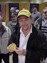
My manuscript for the revision to "Gem Trails of Oregon" is in pretty good shape, but there is still a lot to do. I thought I'd offer up a little commentary on the frantic rush to hit a deadline.
First, I still need to comb through each of the 101 entries for each general locale and make sure I have the sites thoroughly documented. I found two last night that aren't ready, and by far, the Glass Buttes obsidian deposit is the most difficult. Tim Fisher's OreRockOn DVD lists about 15 different GPS coordinates around Glass Buttes, and I don't want to include any more than 5. So I need to whittle what I have down to a manageable number. I have a similar problem with another deposit in SE Oregon, where there are several sites listed in the literature that I need to sort out.
Then there are the fossil locales. Because I am burdened with a geology degree, I feel this insane need to publish formal formation names for various locales. This is especially important with regards to fossil locales, as you like to know the age of the material you are digging up. Late last night I went through several of the limestone locales and ascribed to them the correct geologic information. But a few remain, and there are others that are incidental to the main material collected at a locale. So I have some research to do there, but fortunately the book "Fossils of Oregon" is a great guide.
I have completely worked through each site and verified the GPS coordinates, and in an improvement over my original data, I converted each reading to something simple for Google Earth. In the old days, GPS coordinates would read something like 45 degrees, 25 minutes, 11.5 seconds for the latitude, and 117 degrees, 24 minutes, 54.4 seconds for the longitude. Obviously, using the degrees, minutes, and seconds notation shortens those readings, but not enough. I converted everything to decimals: 45.4354, -117.3895 would be a close approximation for that reading above. There is much less typing involved, and the readings are useful for Google Earth, the most popular (and free) global mapping program. It was a lot of work, but I feel better about the conversion. I also verified the elevation readings, which my GPS unit sometimes messes up.
Lately I also worked on naming for the sites, since I had used some obscure geographical references for a couple sites that nagged at me. I made those changes this week as well. It amazes me how the smallest details grind on me as I try to get this project finished.
I also overhauled a small, eight-cell table I put under each map with information such as road conditions, seasonal availability, relevant maps, nearby attractions, etc. A font glitch required me to go through each table and reformat the text, which was time-consuming.
One final project has been to give better, specific driving instructions for each location. Even though some readers have good GPS units and mapping software, not everyone does. So I spend a lot of space describing how to get somewhere. I try to tie everything to an interstate freeway, as though the reader were driving straight to this location. The truth is, many readers will be coming from a nearby locale, so I have to cover that information as well. There is still some work to do there. Being a big user of guidebooks myself, I feel strongly about getting the mileages correct. But it often requires a lot of tedious work, pasting in the GPS coordinates into Google Earth and working with the ruler to measure road lengths.
The biggest challenge left is drawing site maps for each locale, using Adobe Illustrator. I worked out a template for each map, with a small gray outline of the state marked with faint county lines. I need to put a relative dot on that state icon for each locale, and then draw in lines for roads, rivers, streams, etc. Then I need to place an "X" marks the spot for the specific spot. Each map can take an hour, and I have a hundred to complete before the end of December.
The good news is two-fold; first, I have a new, fast computer at work, with dual flat-screen monitors so I can really stretch out my desktop real estate. Second, my day job goes on hiatus after Christmas. I may come into the office a few times just to work on maps.
Needless to say, I am not getting much sleep. I keep running spell-checker, rooting out passive voice, fixing punctuation, and combing through the text. I have a running debate with myself about how much first-person voice to use. It requires some linguistic gymnastics to write some of the descriptions in a flat, second-person imperative. I want the text to sound personable, and I think it makes the entire book more believable. But sometimes I feel too much of myself creeping in, as though I am writing just for my rockhound uncle. He helped out a lot on the field research this summer, so he shows up on several pages. I wrestle with how much personal information to include.
By New Year's Day, I should be finished. But it looks pretty scary at this point. There is so much to do, and I feel like I am procrastinating on the hardest parts. Plus, I still have to be a father, husband, son, friend, associate...I can't just hunker down and work non-stop. But I like the writing, so I pour a lot of myself into it.
OK, gotta go...
Tuesday, December 18, 2007
Subscribe to:
Post Comments (Atom)


No comments:
Post a Comment