Tuesday, December 18, 2007

Chicken, Alaska

In between many other writing assignments, I write a short column about gold prospecting for Gold Prospectors magazine. Here's the next column:

***

Mining the Internet – Chicken, Alaska

By Garret Romaine

Two years ago I contacted Mike Busby about his website, http://www.chickengold.com and wrote up a few details about the new site, which describe his fee-dig operation up there. I’m happy to report that in the months since then, Mike has put a lot of work into his website (and his mining operation). If you have a vacation planned for the Dawson area, this historic gold camp is right on the way.

Chicken, Alaska reaches a population of about 150 in the summer, and boasts a saloon, rental cabins, a gas station, airport, and public gold panning. In 2007, the Chicken gold camp opened its doors to recreational gold miners, with very good results. The year before, the famed Pedro Dredge, rescued and moved to Chicken in 1998, was named to the National Register of Historic Places.

Gold Discovery

Myer’s Fork flows into Chicken Creek just north of Chicken, and Chicken Creek reaches the Mosquito Fork of the Fortymile River just south of town. Myer’s Fork was the site of the original gold discovery in the Chicken Creek drainage, located in 1896. According to Mike, values on bedrock have run slightly better on Myer’s Fork than on Chicken Creek. The mouth of Myer’s Fork and bottom ¼ mile of the creek have seen hand-mining only. The rest of the creek is still virgin territory.

The Chicken Creek drainage has been mined continuously since 1896, yielding about 100,000 ounces. The F.E. Company, a subsidiary of the U.S. Smelting Refining & Mining Co., acquired most of the claims during the 1940’s and dredged 2 miles of Chicken Creek from 1959 to 1967. Since then, several family operations have mined on the creek.

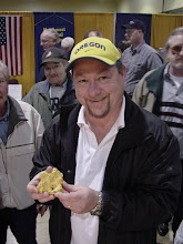
Mike continues: “We began operating the Chicken Creek Mine in 1990 as lessees and purchased ground in 1998. In 2000, we began to implement a sustainable development plan incorporating mining, reclamation, tourism and local history. In 2001, our efforts were recognized by the State of Alaska when we received the prestigious Alaska Governor’s Award for Mine Reclamation. In 2006, we were recognized nationally as the small mine operator of the year by the U.S. Interior Department with the Reclamation and Sustainable Mineral Development Award.

Lately, our mining operation has taken a back seat to the rest of the business, but we continue to operate the Chicken Creek Mine as time permits. When we are operating, you are welcome to view the operation. And when we are not, there is plenty of gold for you to find, since most of the remaining ground is available for panning and recreational mining opportunities.”

Gold nuggets to three ounces are reported from this area. Guests at the claims can work the creek for a daily fee. You can pan, sluice, run a metal detector, or operate a high-banker or sluice. Sluice intakes are limited to two inches in diameter. Rates are subject to change, but run as follows:

$15 per day for panning and metal detecting

$25 per day for hand sluices

$30 per day for high bankers

$40 per day for sluices

Rates are slightly higher for non-camping guests. There are also weekly discounts. The camp offers equipment rentals, concentrate clean-up, and demonstrations.

Pedro Dredge

http://www.explorenorth.com/library/mining/pedro_dredge.html

The Pedro Dredge is open for daily tours and is definitely worth a stop. Mike Busby wrote this article for ExploreNorth.com. The dredge was smaller than most Alaska dredges, as each bucket held only three cubic yards.

Here are a few excerpts:

“The Pedro dredge, originally driven by steam, was built by the Yuba Manufacturing Company in California, and was shipped from Oakland on the S.S. Point San Pablo on April 1, 1938. It was assembled on Pedro Creek and began operating on July 11th. The Dredge operated on Pedro Creek, with the exception of the war years, until October 1958. Having completed its available ground there, it was decided to move it to Chicken Creek, as the Cowden Dredge, also belonging to the company, had suffered from years of neglect.”

“During its production years on Chicken Creek, the dredge washed about 2,500 cubic yards of gravel each day (29 buckets per minute) at a cost of around 30 cents per cubic yard. Between 0.30 and 0.80 ounces of gold were recovered from each cubic yard of gravel. There were normally 16-20 men employed in the operation, with 10-12 involved directly with the dredging and the remainder mostly associated with thawing ground ahead of the dredge. The dredge mined over 55,000 ounces of gold in the eight years on Chicken Creek.”

“Until 1998, the Pedro Dredge was hardly visible, resting on upper Chicken Creek where it had been parked in 1967. In the fall of 1998, the dredge was moved a mile to it's present location in the center of Chicken by it's new owner, Bernie Karl, and the owner of the mining claims, Mike Busby. The million-pound artifact was moved in one piece, and took less than two weeks of preparation and two weeks of actual moving, during which 120 tires were used to support it.”

Tisha’s Grave

At the north end of Chicken is a small grave marker with the following history behind it:

From http://www.explorenorth.com/library/bios/purdy-ann_hobbs.html: “Anne Hobbs Purdy was born on November 10, 1901 in Missouri, and grew up in Longmont, Colorado. She came to Alaska in 1928 and taught for the Bureau of Indian Affairs in Eagle, Tetlin, and Chicken. She married a gold miner, Fred Purdy of Chicken, Alaska, in 1940. The couple adopted and raised eleven children. In 1976, Anne Purdy wrote a popular book, Tisha, based on her experiences as a teacher. She also wrote another book, Dark Boundary, as well as numerous newspaper and magazine articles. Anne Purdy died at Dot Lake on April 15, 1987.”

I haven’t read the book, but Maudeen Wachsmith provided a short review at Amazon.com:

“Anne Hobbs is a prim and proper 19-year-old schoolteacher who yearns for adventure. She finds this and much more in a town with the unlikely name of Chicken, located deep in the Alaskan interior. It is 1927 and Chicken is a wild mining community flaming with gold fever. Anne quickly makes friends with many of the townspeople, but is soon ostracized when she not only befriends the local Indians but also falls in love with one.”

More info

http://www.explorenorth.com/library/communities/alaska/chicken.html

There are additional reference links form this page, taking you to information about the Chicken Hotel, downtown Chicken, several other large-scale dredges that offer tours, and a geologic map of the Chicken, Alaska area. Note in particular the large granitic intrusion north of Chicken, bounded by Devonian phyllite, quartzite, chert, limestone, greenstone, slate and tuff. From my limited prospecting experience, any area with a granite intrusion and local greenstone is ripe for exploration.

Additional References


Myers Fork is cited in the following literature:

Cobb, E.H., 1977, Summary of references to mineral occurrences in the Eagle quadrangle, Alaska. U.S. Geological Survey Open-File Report 77-845, 122 p.

Foster, H.L., 1969, Reconnaissance geology of the Eagle A-1 and A-2 quadrangles, Alaska. U.S. Geological Survey Bulletin 1271-G, p. G1-G30.

Mertie, J.B., Jr., 1938, Gold placers of the Fortymile, Eagle, and Circle districts, Alaska. U.S. Geological Survey Bulletin 897-C, p. 133-261.

Prindle, L.M., 1909, The Fortymile quadrangle, Yukon-Tanana region, Alaska. U.S. Geological Survey Bulletin 375, 52 p.

Prindle, L.M., 1905, The gold placers of the Fortymile, Birch Creek, and Fairbanks regions, Alaska. U.S. Geological Survey Bulletin 251, 89 p.

Yeend, W., 1996, Gold placers of the historical Fortymile River region, Alaska: U.S. Geological Survey Bulletin 2125, 75 p.

Down to the wire

My manuscript for the revision to "Gem Trails of Oregon" is in pretty good shape, but there is still a lot to do. I thought I'd offer up a little commentary on the frantic rush to hit a deadline.

First, I still need to comb through each of the 101 entries for each general locale and make sure I have the sites thoroughly documented. I found two last night that aren't ready, and by far, the Glass Buttes obsidian deposit is the most difficult. Tim Fisher's OreRockOn DVD lists about 15 different GPS coordinates around Glass Buttes, and I don't want to include any more than 5. So I need to whittle what I have down to a manageable number. I have a similar problem with another deposit in SE Oregon, where there are several sites listed in the literature that I need to sort out.

Then there are the fossil locales. Because I am burdened with a geology degree, I feel this insane need to publish formal formation names for various locales. This is especially important with regards to fossil locales, as you like to know the age of the material you are digging up. Late last night I went through several of the limestone locales and ascribed to them the correct geologic information. But a few remain, and there are others that are incidental to the main material collected at a locale. So I have some research to do there, but fortunately the book "Fossils of Oregon" is a great guide.

I have completely worked through each site and verified the GPS coordinates, and in an improvement over my original data, I converted each reading to something simple for Google Earth. In the old days, GPS coordinates would read something like 45 degrees, 25 minutes, 11.5 seconds for the latitude, and 117 degrees, 24 minutes, 54.4 seconds for the longitude. Obviously, using the degrees, minutes, and seconds notation shortens those readings, but not enough. I converted everything to decimals: 45.4354, -117.3895 would be a close approximation for that reading above. There is much less typing involved, and the readings are useful for Google Earth, the most popular (and free) global mapping program. It was a lot of work, but I feel better about the conversion. I also verified the elevation readings, which my GPS unit sometimes messes up.

Lately I also worked on naming for the sites, since I had used some obscure geographical references for a couple sites that nagged at me. I made those changes this week as well. It amazes me how the smallest details grind on me as I try to get this project finished.

I also overhauled a small, eight-cell table I put under each map with information such as road conditions, seasonal availability, relevant maps, nearby attractions, etc. A font glitch required me to go through each table and reformat the text, which was time-consuming.

One final project has been to give better, specific driving instructions for each location. Even though some readers have good GPS units and mapping software, not everyone does. So I spend a lot of space describing how to get somewhere. I try to tie everything to an interstate freeway, as though the reader were driving straight to this location. The truth is, many readers will be coming from a nearby locale, so I have to cover that information as well. There is still some work to do there. Being a big user of guidebooks myself, I feel strongly about getting the mileages correct. But it often requires a lot of tedious work, pasting in the GPS coordinates into Google Earth and working with the ruler to measure road lengths.

The biggest challenge left is drawing site maps for each locale, using Adobe Illustrator. I worked out a template for each map, with a small gray outline of the state marked with faint county lines. I need to put a relative dot on that state icon for each locale, and then draw in lines for roads, rivers, streams, etc. Then I need to place an "X" marks the spot for the specific spot. Each map can take an hour, and I have a hundred to complete before the end of December.

The good news is two-fold; first, I have a new, fast computer at work, with dual flat-screen monitors so I can really stretch out my desktop real estate. Second, my day job goes on hiatus after Christmas. I may come into the office a few times just to work on maps.

Needless to say, I am not getting much sleep. I keep running spell-checker, rooting out passive voice, fixing punctuation, and combing through the text. I have a running debate with myself about how much first-person voice to use. It requires some linguistic gymnastics to write some of the descriptions in a flat, second-person imperative. I want the text to sound personable, and I think it makes the entire book more believable. But sometimes I feel too much of myself creeping in, as though I am writing just for my rockhound uncle. He helped out a lot on the field research this summer, so he shows up on several pages. I wrestle with how much personal information to include.

By New Year's Day, I should be finished. But it looks pretty scary at this point. There is so much to do, and I feel like I am procrastinating on the hardest parts. Plus, I still have to be a father, husband, son, friend, associate...I can't just hunker down and work non-stop. But I like the writing, so I pour a lot of myself into it.

OK, gotta go...

Monday, December 10, 2007

Why try?

One of my friends asked me recently why I am standing for election to the Society for Technical Communication Board of Directors. After all, I ran several years ago and lost by 21 votes, so why risk public humiliation one more time?

I guess the short answer is because I think I can be of service. Technical communication has been good for me over the years; it has put a roof over my head and put food on the table. I've met interesting people, worked at energetic companies, and been part of inspirational teams. Plus, the constant vocabulary lessons have been good for my Scrabble game. So on many levels, I feel the need to give back.

I believe in the old electoral adage, "If you don't vote, you can't complain." Stated another way, if you don't participate in elections with your vote, you shouldn't really vocalize your displeasure with how things are run. STC members are like any other members of professional organizations -- voting participation is anemic. But taken to the next level, is just voting enough? Shouldn't members work hard as volunteers, finding ways to plug into the organization and work to make it better?

I think they should. Over the years, I have served the Society in many, many roles. In each case, I like to thing I got something back in return. When I ran the Employment committee, I learned a lot about sending out email blasts, including the last-minute triple-check that saves so much public embarassment. I also made a lot of contacts with local employers, and got first-hand glimpses about many of the managers in the local area. When I served as a competition volunteer, I started really inspecting my own documentation as a judge would see it, and I like to think that made me a better writer.

So now comes the chance to work for change at a national level. I know that a lot of members are disappointed that dues rose significantly, and I hear complaints about the Transformation that I admit I am sympathetic to. At the same time, I have met (and worked with) some of the Board members, and I believe they voted in some of the more controversial measures based on the best information they had at the time. Change is always painful if it is significant. Yet people adapt and move on. We are resilient.

Plus, many of the age-old complaints are still out there. Organizations sometimes discount our value. Engineers sit on reviews and complain about deadlines. Our managers seem to face continually dwindling budgets. Outsourcing is a real threat. Still, tools continue to evolve and schools continue to churn out graduates. Life goes on.

If elected, I plan to bring a lot of energy to this new task. I plan to do my homework, come prepared to meetings, and communicate back to members as best I can. I know that I'm a longshot to win -- being based in the Pacific Northwest, I don't have what you would call a big constituency backing me. So I'm realistic, if not fatalistic. There are eight great candidates for only four openings, and it is an honor just to be included in the group, come what may.